Monday, April 30, 2012

Pike's Peak


Our luck with weather is holding, so we headed for Pikes Peak.

Before we could go we had to fix our problem of not accessing the satellites for TV. We moved the coach forward and back in the space we were in, but had no luck. We eventually changed sites and were able to get reception. It set our timetable back about two hours, but we finally were on our way. AND, Barbara gets to watch DWTS tonight.

When I last lived in Colorado Springs and took the drive to the top of Pikes Peak the road was dirt and gravel most of the way. Today it is paved all the way to the top. It makes the drive easier, but I have to wonder about the changes for the Pikes Peak Hill Climb auto race that this forces.

Once at the top the views were magnificent. I swear I could see Kansas.  It was very windy and cold up there so we went into the visitor center and got fresh (oily) donuts and coffee (not bad actually).


Driving is not the only way up. There is also a cog railway that will bring you up. The views from the railroad are great, but so are those from the car and you save $35 per head.


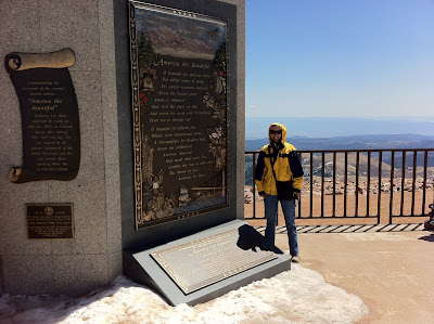
The song America The Beautiful was inspired by the views from the top of Pikes Peak and a monument to the writer (Katherine Lee Bates) has been added since I was last up there. 


The trip down was a gas. Barbara leaned in towards me every time we got close to the edge on the turns. Most of the trip down was done in first or second gear. Quite a ride!

We ended the afternoon driving through The Garden of the Gods. It is a nice city park that features rock formations similar to those in Moab. It was a quick visit, but when Barbara gets back we will do some hiking through the park.


We finished the day in an appropriate way. No, not the wine, the call to Barbara's mom. 

Author at work.  Pay no attention to the bulge above the belt.

Sunday, April 29, 2012

Colorado Springs


We arrived at the Air Force FamCamp before three and got set up. The drive over from Gunnison was very scenic. We crossed Monarch Pass in fine shape and it goes in the record books for the highest elevation we have driven the coach. The pass is 11,312 feet!


Once over the pass we turned north just short of Salida and took Hwy 285 to Buena Vista where we turned east on Hwy 24 through Woodland Park to Colorado Springs. As we approached Woodland Park we could see the western slopes of Pikes Peak.


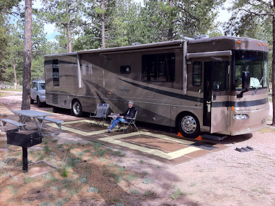
The Air Force Academy campground is very nice with wooded spaces.


Unfortunately, the trees are in the way of the satellite reception. Luckily, we are close to Colorado Springs and their commercial over the air stations. The only downside is the train noise. There is a coal train through here about every half hour. Can’t see it, but it is certainly heard. Hopefully they will not run through the night. The coal is coming from mines in Wyoming and it is amazing just how much is being shipped south over Raton Pass and from there to markets east and west.

I will be here for several days while Barbara returns home to spend some time with her mom. When she returns we will do some sightseeing here in the area and then head on towards Moscow, IA to have the slide out repaired at HWH.

Saturday, April 28, 2012

Black Canyon of the Gunnison, CO


We may have miscalculated where to stop for the night if we really wanted to go to the Black Canyon of the Gunnison National Park. We had to drive nearly all the way back to Montrose. It was well worth the drive, though.

This is one of the newer National Parks. While it was designated a National Monument in the 1930’s, it was not until 1996 that it became a national park.

Early Native American’s inhabited the area of the canyon, but above the rim since the gorge itself was pretty much inaccessible due to the steep canyon walls and narrow riverbed.


Uncompaghre Valley from High Point Overlook.


Intrepid surveyor’s began searching for a train route through the canyon in the late 1800’s, but labeled the canyon impenetrable. By 1900 local ranchers were trying to get access to the river water for irrigation, but exploratory trips down the river by boat to find a way to divert water to the Uncompahgre Valley were not successful. The boats were crushed on the rocks and their supplies were lost. A year later two surveyors were successful in using inflated rubber mattresses. They did find a potential location to begin a tunnel through the mountain and a nearly six mile long tunnel was eventually dug straight through solid rock to bring irrigation water to the valley. When you stand here and look at the gorge you can see what an unimaginable feat that was.

Engineering aside, this is a stunningly beautiful area and we were able to get another couple of miles of hiking done. Thankfully, the hiking trails here are well maintained and, apart from the steep grades, easy walking.


After hiking the rim trails we drove to the river level to see the tunnel entrance. Yes, it is still in use. The road to the canyon floor is very steep and winding and they make that clear at the start.


The tunnel entrance is beneath the small building that houses the gate that opens the tunnel during growing season. The tunnel is dry the remainder of the year.


The road out of the canyon is seen snaking up the center of this photo. It descends nearly 2000’ in a horizontal mile. 


Other factoids are that the river in the canyon descends a greater distance in its 48-mile length than the Mississippi does in its 1500 mile run from Minnesota to the Gulf of Mexico. At a normal peak flow the river moves 12,000 cubic feet of water per second. This is its low period of about 500 cubic feet per second, so you can imagine what it is like at full rage.

Tomorrow morning we are off to Colorado Springs and the FamCamp at the Air Force Academy where I will stay while Barbara returns home for a week.

Friday, April 27, 2012

Gunnison, CO


We left Moab around ten this morning and had a good four-hour drive to Gunnison. The wind really picked up about the time we reached Grand Junction and turned south towards Montrose. That gave us a cross wind of about fifteen miles an hour until we turned east at Montrose. At that point the wind was less trouble even if it was stronger. Highway 50 is a little wavy in places and the new shocks were a blessing. Once in the mountains it got pretty steep and winding, but the coach did well.

We arrived at the Mesa RV Park a little before three and got settled in. The park is about five miles west of Gunnison along the Gunnison River. Nice and quiet.

We took the car into town to look around. Gunnison is a nice town that caters to the Crested Butte skiers in the winter and many summer sports when in season. After strolling the main street we had an early dinner at the Ol’ Miner Steakhouse.  Barbara had a craving for a big burger and I ordered a New York Strip. Both were fantastic. I washed the steak down with a Fat Tire, a Colorado brew by New Belgian Brewery. If you come through Gunnison around mealtime stop in. I am sure you will like it.


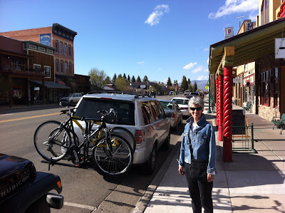
Main drag looking towards Crested Butte 28 miles to the north.


We got back to the campgound and got laundry started. Barbara finally got to see some wildlife other than cows. A deer walked right past the coach. Barbara is trying to catch up to it now with her camera. Seems it is always put away somewhere when you need it.


Tomorrow we hope to see the Black Canyon of the Gunnison National Park

Thursday, April 26, 2012

Dead Horse Point State Park, UT


The weather was to be less than nice today in Moab, and then tomorrow in Gunnison, CO our next stop. The plan was to leave for Gunnison tomorrow, so we thought we would just stay here one more day. We checked at the office and found that the space we are in is booked, as are all other spaces. There is an auto show in town over the weekend and it evidently draws a crowd.

We called the Gunnison RV park and reserved a day earlier, then set off for Arches National Park to hike to the major arch that we did not get to the other day. We knew that rain was expected, but that it was most likely in the afternoon.

Landscape Arch is an oft-photographed arch. Many have probably seen pictures of it. But it is not possible to just drive up to it for a look. Like Delicate Arch, it is necessary to hike to it. Thankfully the one and a half mile hike to reach it was less arduous than the climb to Delicate Arch. 


Along the way we passed two smaller arches.


Once there the arch seemed a bit smaller than I imagined, but it was still impressive.


We thought we could get more hiking in before the weather would turn bad, so we started out for Double-O Arch which was a little more than a mile further up the trail. This trail turned out to have a lot of steep rocks to traverse. We got as far as Navajo Arch when the wind kicked up and intermittent light rain began. Discretion being the better part of valor, we started back. The sandstone rocks are pretty well worn by foot traffic and would be pretty slick when wet. The trip back was into a head wind of 15-20 MPH with higher gusts where it came through the gullies between the rock walls. The rain was not so bad, but we were getting sand blasted. A thin layer of fine grit covered us by the time we got to the car.

We drove over to Dead Horse Point State Park where we knew we would be able see the park and views from vantage points within a short walk from the parking lot. If it rained we would just wait for it to clear. As it turned out we were able to see much of the park before serious rain hit.


The blue watery areas in the distance are evaporating ponds at the Liberty Potash (Potassium Chloride) mine. Water is injected into large salt deposits beneath the earth’s surface, and then pumped up to the surface where the water is evaporated off and the potash scrapped up. The blue is a dye added the solution to hasten evaporation.


That is the Green River in the background.
Our timing wasn’t the best. We got to Dead Horse Point right behind a bus of Japanese tourists. Luckily I am tall and could still get pictures of the canyon below. 


Lightening started to flash in the area, so getting off the metal viewing platform seemed a good idea.

On the way home we stopped so Barbara could get a picture of the rain coming across the canyon.


Oops!  


Not really. This is the turn around pooint for us. Tomorrow we start working our way back east.

Wednesday, April 25, 2012

Canyonlands National Park, UT


Today was cloudy and because of that, a good bit cooler. We could appreciate the cooler weather, but the lack of bright sun has left our photos of today a little washed out. Sorry.

We headed out to Canyonlands National Park with the guidance of the Garmin GPS. It took us for a nice ride along the Colorado River. Canyonlands NP covers the area where the Colorado and Green Rivers merge prior to flowing through the Grand Canyon. As majestic as the Grand Canyon is, this area is awesome as well.


Thank you Mr. Garmin.


 The GPS took us on a pretty route that required a 4X4 to complete. We had to turn back and head back to the main highway where the GPS finally decided on the correct path to the National Park via pavement.


Don't tell OSHA there are no guard rails. Just past the bush in the center foreground is a 1200' drop.


One of the interesting geological features was the “Upheaval Dome”, a large crater whose origins are a bit of a mystery. Some experts think it is a collapsed salt dome where the crusty layer of rock above a salt deposit collapsed when the salt was washed away by ground water. Other experts think that a meteorite impact caused the crater. Either way, it is an impressive crater and an awesome hike to see.


Tuesday, April 24, 2012

Arches National Park, UT


Well, we chose Arches National Park, and it was a great choice. The Golden Age Pass is a wonderful thing. It got us in once again for free, gratis. If you are “of an age” you must get one. For the first time since the start of this trip we are getting a chance to do some hiking. Today it was 90 degrees and the winds were 15 MPH.

Westerners originally settled the area we now call Arches NP in the late 1890’s. A fella by the name of Wolf and his young son set up camp in the area next to a small stream. With a steady source of water they were actually pretty successful. His daughter joined them a few years later and the family managed the ranch well into the 1930s.

The Wolf’s original home is still standing.


The name Arches NP is certainly descriptive. There are many natural arches in the park and the area is continuing to develop new arches, albeit very slowly.


While at "Windows" I tried to get you a feel for the scope of these formations using my iPhone's video feature, but the wind was blowing me around quite a bit and it resulted in a shaky show.

The arch used on the Utah license plate is “Delicate Arch”. While this arch can be viewed from a pull-off on the park road, we elected to get a hike in. Supposedly this was to be a three mile hike. I suppose it was, but they did not mention that it was at a forty-five degree angle. We are at an altitude of about 3900’ here, and we have been at this or higher elevations for the last two weeks. We are reasonably acclimated to the altitude, but this hike was a bear.

The reward was a close up view of Delicate Arch from an angle that only the hardy (or young) will see.


Barbara points to the parking lot off in the far distance on our way back from "Delicate Arch". The lot is about a hand above her finger.


We finished the day with an anniversary toast with a very nice cab compliments of son Chris and his wife Lisa.

Tomorrow we will move on to Canyonlands National Park. We will be entering from the north. There is another entrance about an hour and a half south, but that portion of the park will have to wait for our next visit.